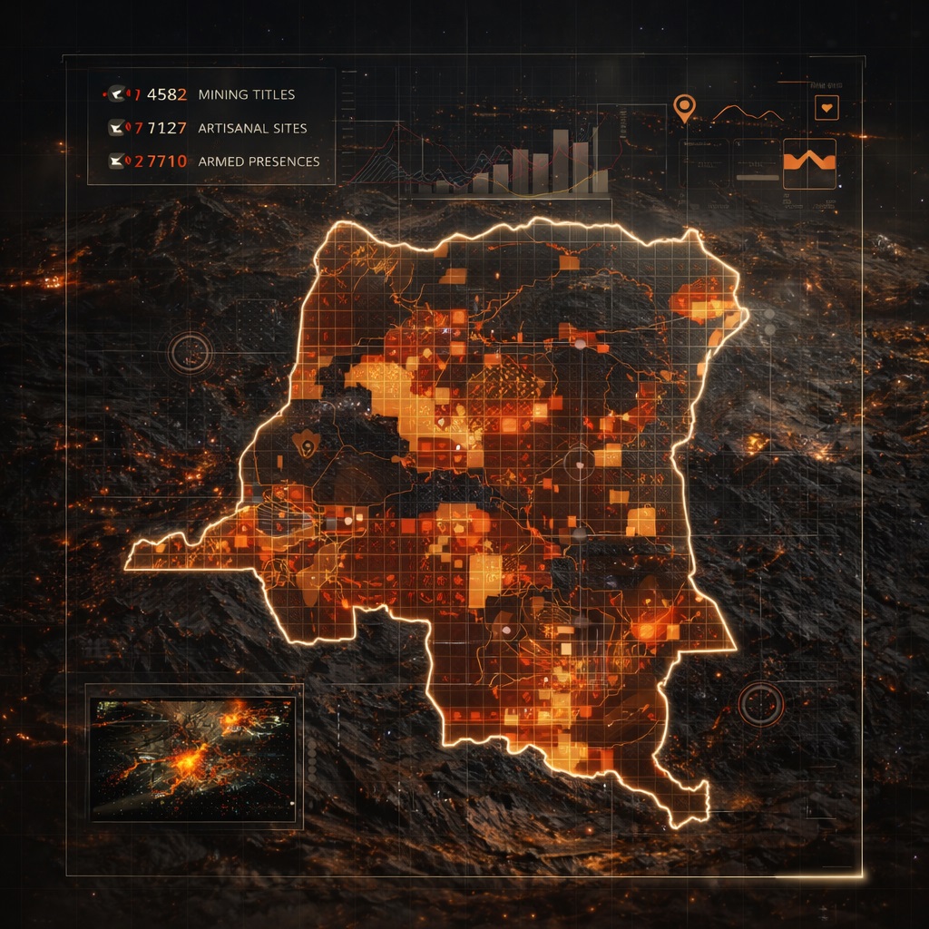
The DRC Mining Cadastre Portal (CAMI) hosts one of Africa's most transparent mining registries — but navigating it requires hours of manual work. BAKAP DataLabs has built an automated extraction and cross-referencing engine that pulls, structures, and enriches every active license, application, and artisanal zone.
Cross-referenced with IPIS field data — the gold standard for artisanal mining and armed presence documentation in eastern DRC — the platform delivers a risk-scored, map-ready intelligence layer updated every business day.
Every data point traces back to an authoritative primary source. No estimates, no aggregators — direct extraction from official government and field research databases.
01 / OFFICIAL REGISTRY
CAMI
Cadastre Minier — Ministry of Mines, DRC
The official DRC mining cadastre. Every active license, application, quarry authorization and artisanal zone — with legal boundaries, titleholder names, expiry dates, and commodity declarations. Data updated every business day.
Since 2009, IPIS has conducted field surveys at over 2,800 artisanal mining sites in eastern DRC — the most comprehensive ground-truth database of ASM activity, armed group interference, child labor, and mineral traceability on the continent.
7,127 ASM sites2,710 armed presencesGPS coordinatesOpen data
03 / ADMINISTRATIVE
Geo Layers
CAMI / ESRI ArcGIS — Province & Territory Boundaries
Administrative boundaries for all 26 DRC provinces, territories, and protected areas — enabling spatial filtering by jurisdiction, cross-referencing with conservation zones, and regulatory compliance checks.
"Is this ground available for an exploration application?"
Instantly visualize which blocks are licensed, which are pending application, and which are truly open — overlaid on provincial boundaries and protected areas. Replace hours of manual CAMI navigation with a 10-second answer.
Value: Field decision in hours, not weeks
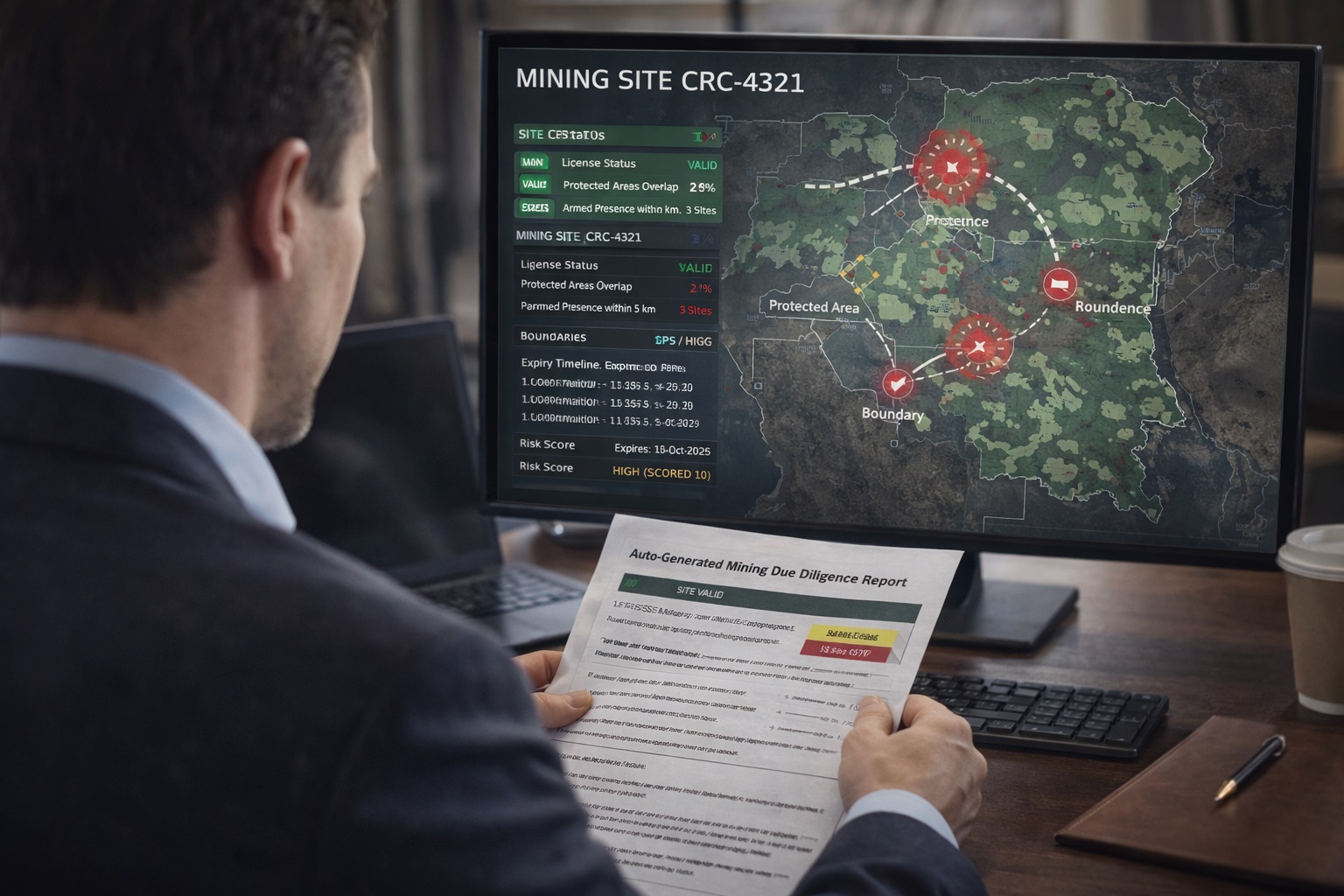
Investment Fund / DFI
"Is this mining asset legally secure and operationally safe?"
Auto-generated due diligence report: license validity, boundary coordinates, nearby armed presences from IPIS data, overlap with protected areas, expiry timeline, and risk score — in a shareable PDF.
Value: $2,000–$15,000 per report
Mining Lawyer / Law Firm
"Is this license clean before my client signs the acquisition?"
Full license history, status, titleholder chain, boundary data, and conflict flag — pulled in seconds rather than waiting days for a CAMI response. Each verification billed at a flat per-report rate.
Value: Billable to client at 5x
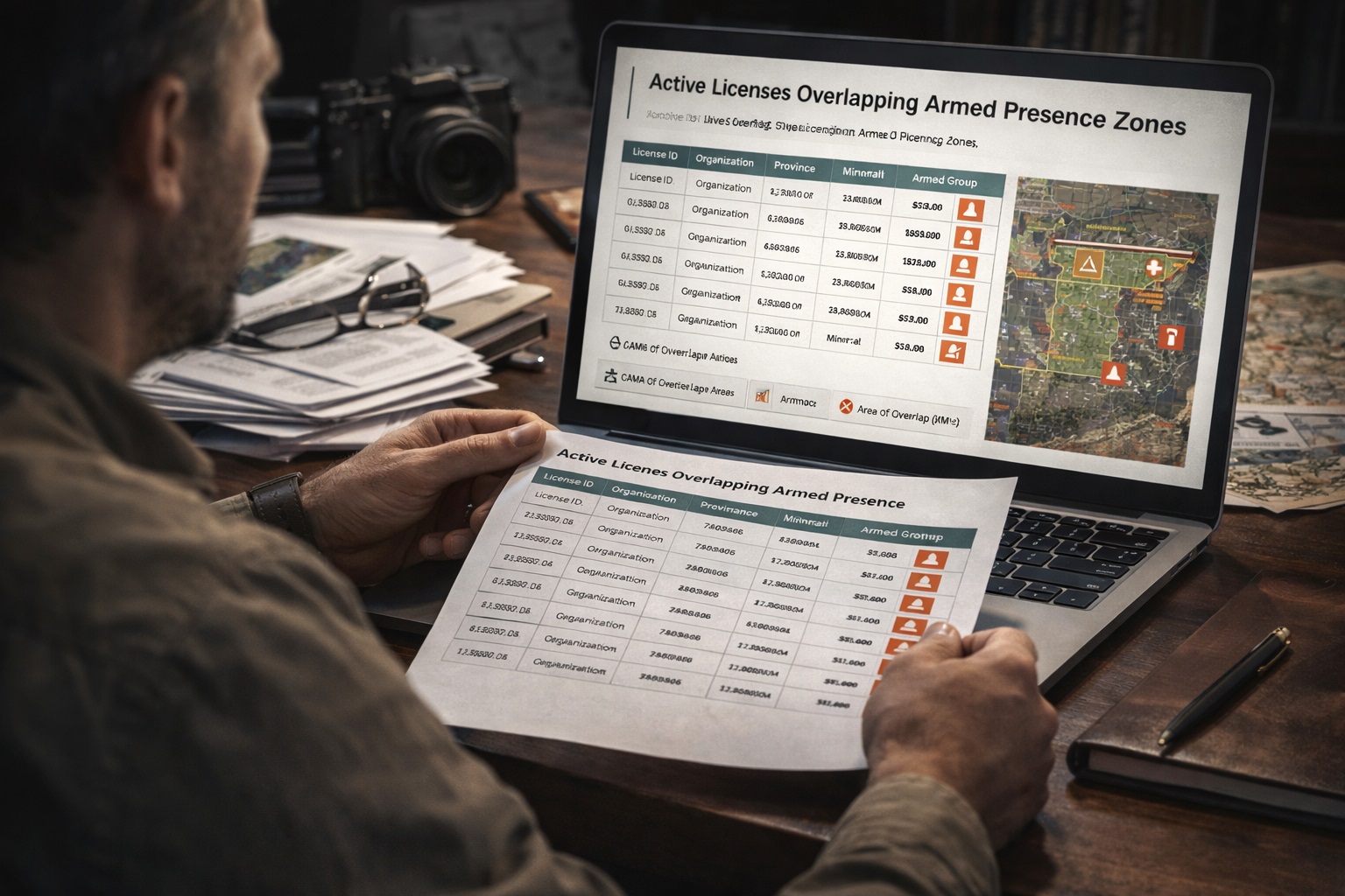
Investigative Journalist / NGO
"Which active licenses overlap with documented armed zones?"
Cross-reference CAMI licenses with IPIS armed presence data. Export a dataset of all licenses where IPIS documents armed group interference within or adjacent to the licensed polygon. Filter by group, mineral, or province.
Value: Data for investigations & advocacy
Provincial Government
"What mining activity is occurring in my territory?"
A jurisdiction-specific dashboard showing all active licenses, pending applications, expired titles still in operation, and artisanal zones — with export to Excel for fiscal reconciliation and enforcement tracking.
Value: Annual government contract
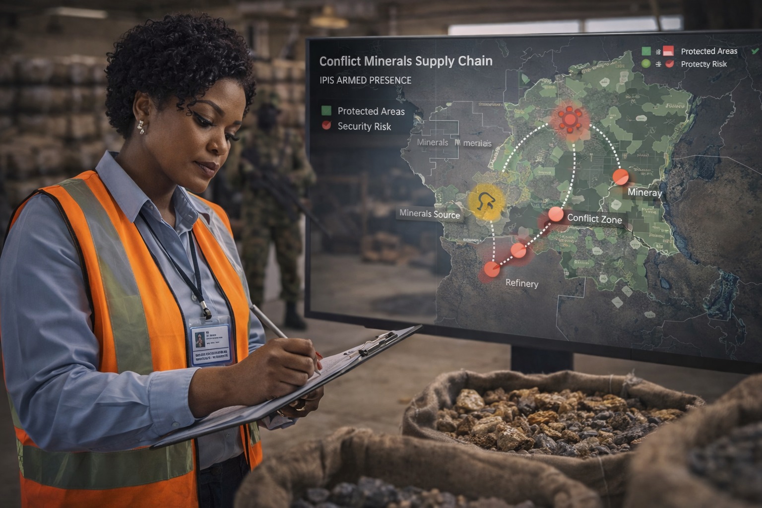
Supply Chain / Compliance Officer
"Does my mineral supply chain pass through conflict zones?"
EU Conflict Minerals Regulation requires companies to verify their 3T & gold supply chains. Map your sourcing locations against IPIS armed interference data and generate an audit-ready compliance report.
Value: EU regulatory compliance
Risk Intelligence
Every site gets a risk score.
No other platform in the world computes an automated, spatially-anchored security risk score for DRC mining assets. We cross every CAMI license polygon against the IPIS ground-truth database to produce a 0–100 risk index.
70 – 100
Active armed group at or near the site. Operational risk confirmed by IPIS field survey.
No documented armed presence. Zone considered operationally safe per available IPIS data.
// Risk Score Algorithm
// Input: CAMI polygon + IPIS site data
score = 0
// Armed interference (IPIS field)
if interference == true:
score += 40
// Armed presence documented
if armed_presence == true:
score += 30
// Named armed group on file
if armed_group != null:
score += 20// per group
// Child labor indicator
if child_labor == true:
score += 10
return min(score, 100)
"The DRC holds some of the world's most critical mineral reserves — cobalt, coltan, gold, cassiterite. The gap between what exists on paper and what exists on the ground costs investors billions and miners their safety.
— BAKAP DataLabs, bridging that gap since day one."
Pricing
Access the data. At every scale.
From a single due diligence report to enterprise API access — structured to match the way mining professionals actually work.
Tell us about your use case — investment due diligence, legal verification, supply chain compliance, or government analytics. We'll match you to the right plan and give you a live walkthrough of the platform.
No commitment. We'll respond within one business day.