Ministère de l'Environnement
"Comment produire notre rapport CDN annuel sans envoyer des équipes terrain ?"
CarbonMRV génère automatiquement les données MRV nationales conformes UNFCCC — couverture forestière, stocks de carbone, variations annuelles — à partir de Sentinel-2. Le ministère soumet son rapport avec des données continues, pas des estimations. Le coût passe de $400,000 par rapport consultant à $2,400 par mois d'abonnement.
Valeur: Conformité Paris Agreement continue
Carbon Project Developer
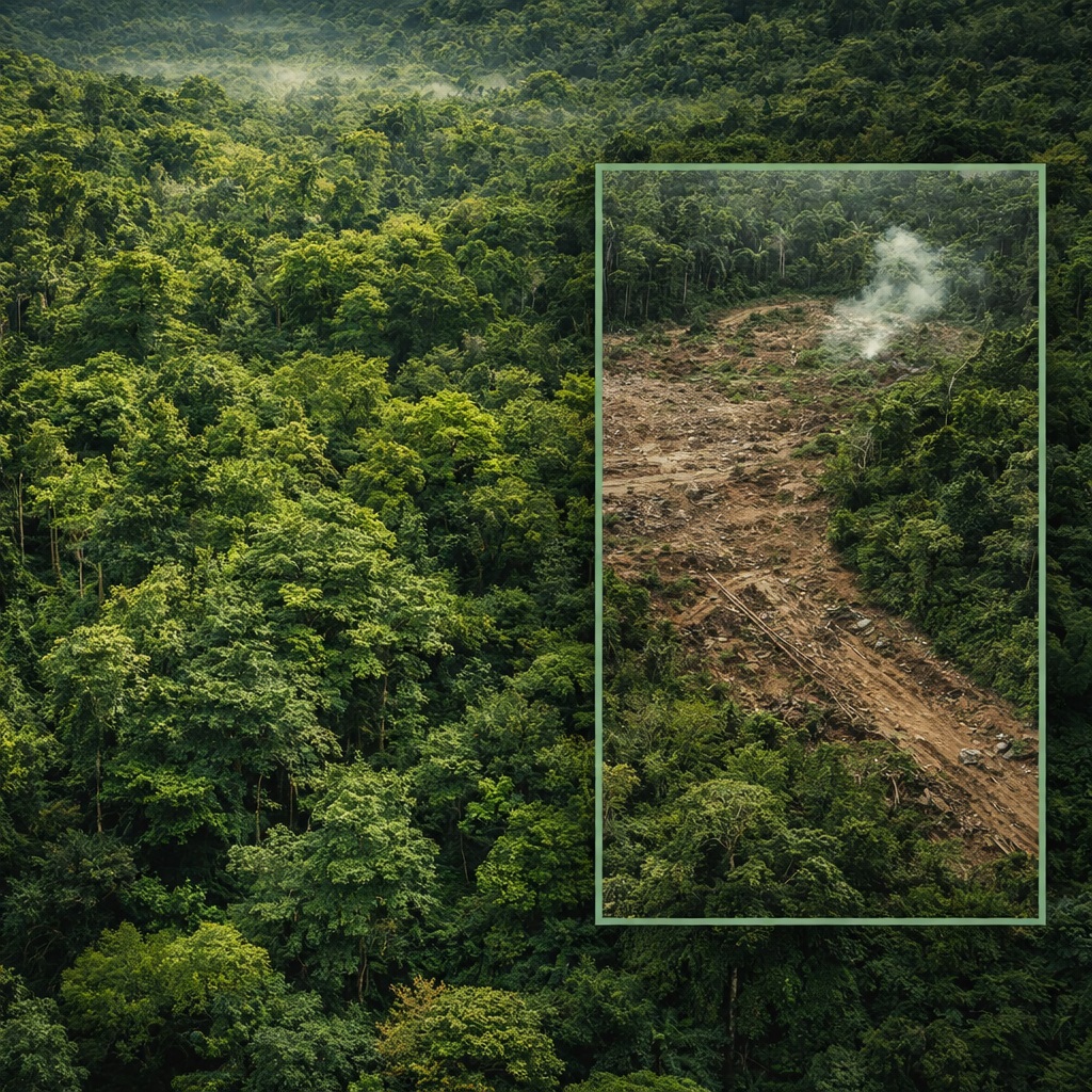
"How do I prove my project is actually protecting the forest it claims to protect?"
ProjectVerify produces an independent third-party satellite verification report for every vintage year — additionality confirmed, boundary integrity monitored, leakage zones identified. The report is delivered in Verra-compatible format and can be attached directly to the credit issuance request.
Value: Credits issued 60% faster with independent verification
Corporate ESG Buyer
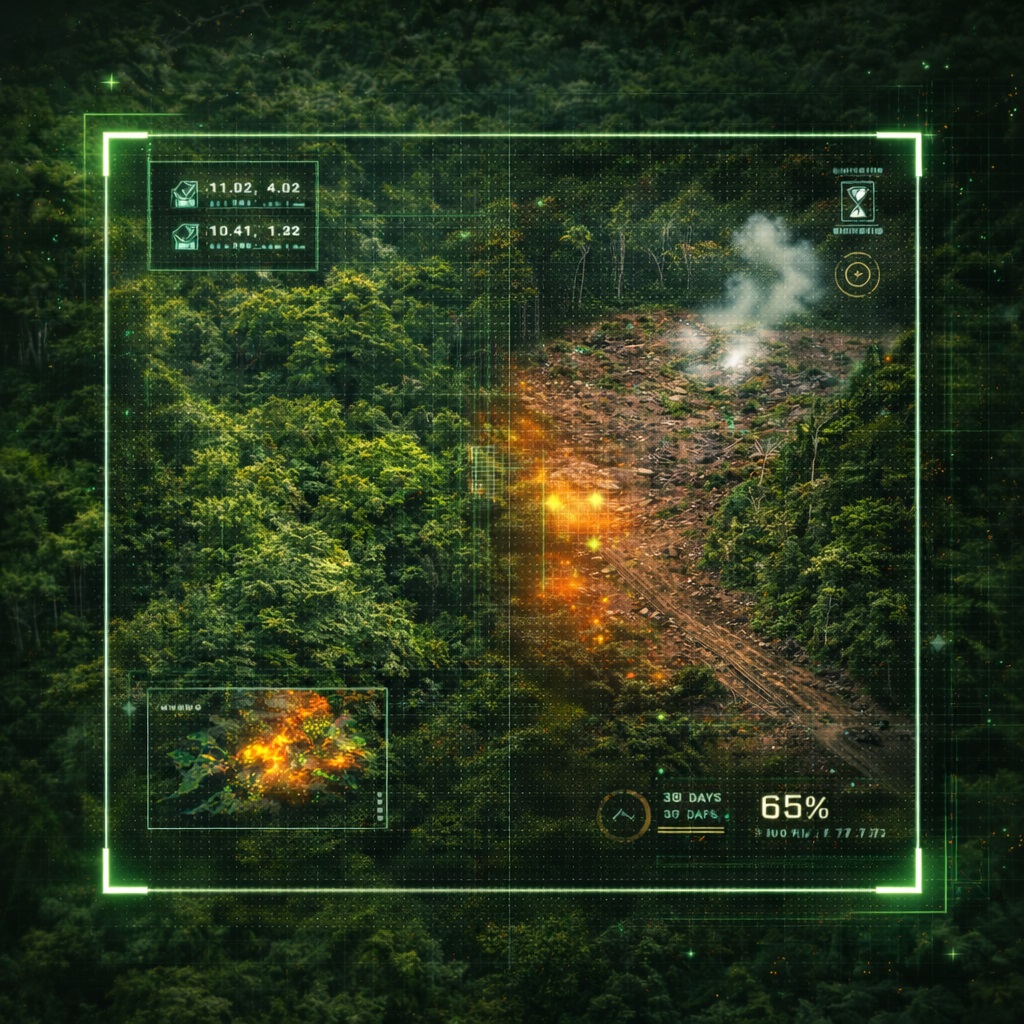
"Are the carbon credits I purchased last year still backed by standing forest?"
ForestWatch monitors project boundaries in real time and sends automated alerts if deforestation is detected within or adjacent to the registered area. The corporate buyer gets a continuous chain of evidence — not just a certificate issued once and never revisited.
Value: ESG audit-proof carbon portfolio
DFI / Green Climate Fund
"Is this REDD+ project delivering the results we funded?"
GCF and AfDB require results-based payments verified by independent MRV. MSITU provides the satellite evidence layer that triggers disbursement tranches — replacing expensive field missions with continuous remote monitoring that meets GCF technical standards.
Value: Results-based payment verification automated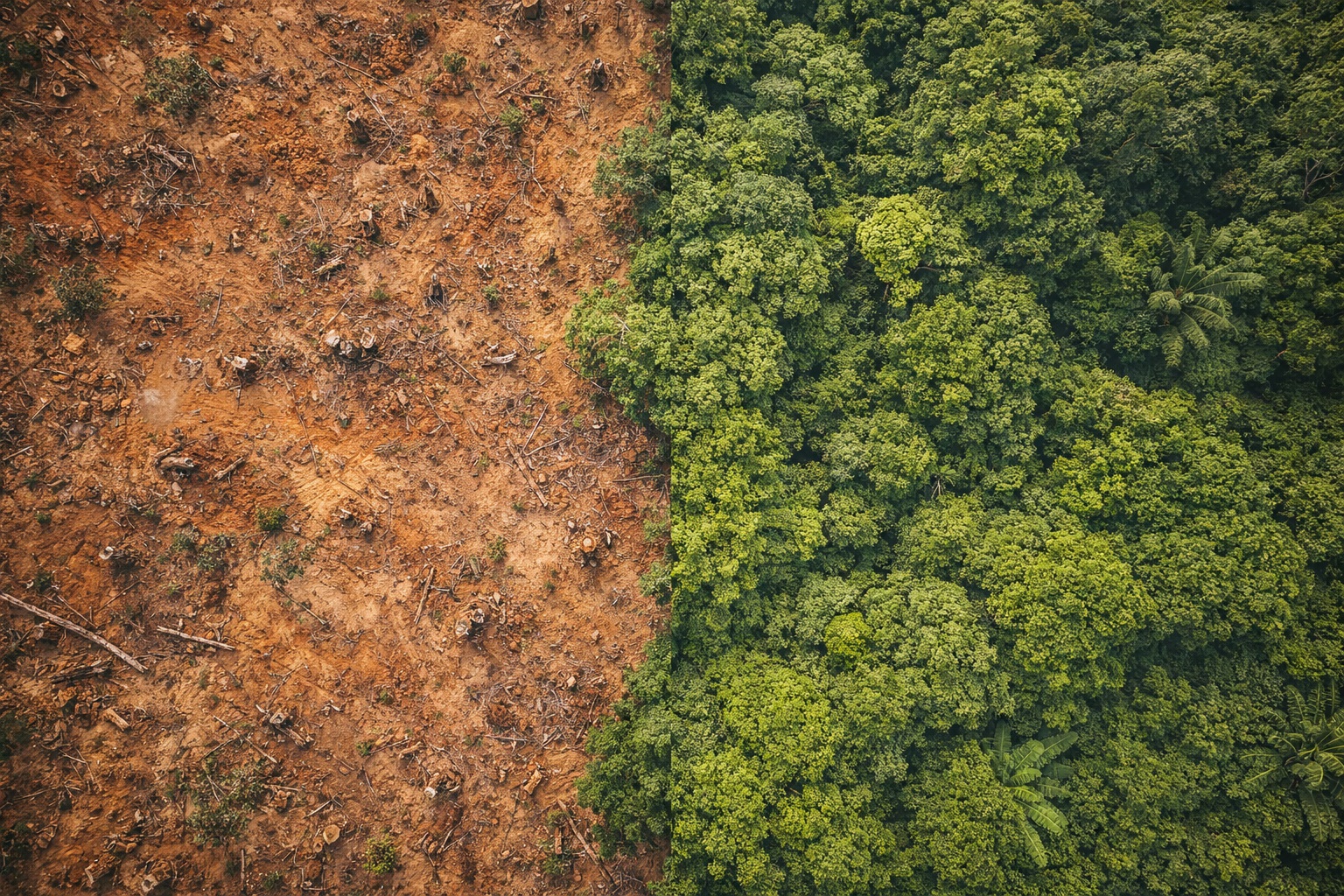
Carbon Investment Fund
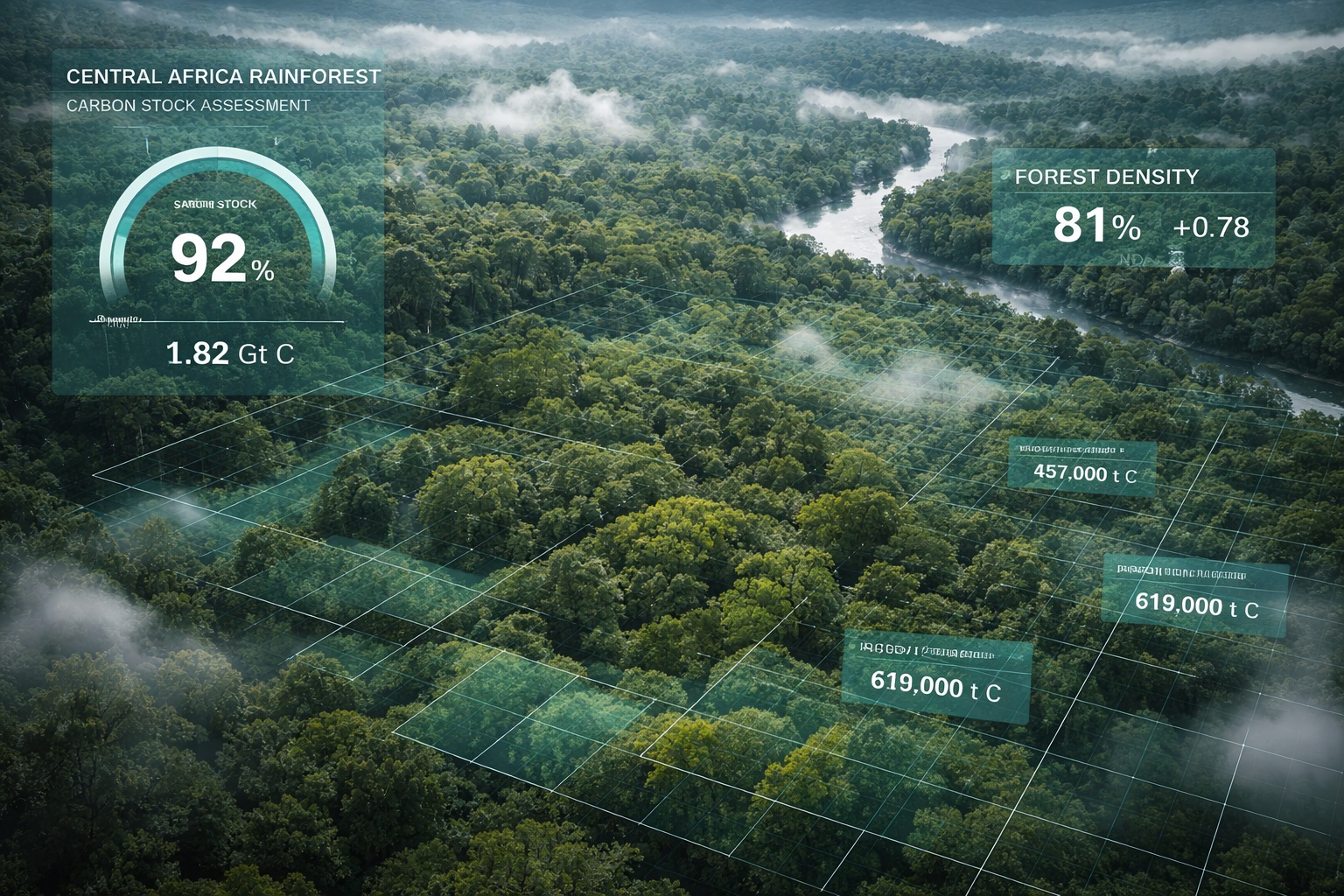
"Which African forest projects are genuinely low-risk investments?"
MSITU scores every project in its database by permanence risk — the probability that the protected forest will be lost before the credit's retirement date. Deforestation pressure maps, community encroachment indicators, and fire risk indices combined into a single investability score.
Value: Portfolio due diligence in hours, not months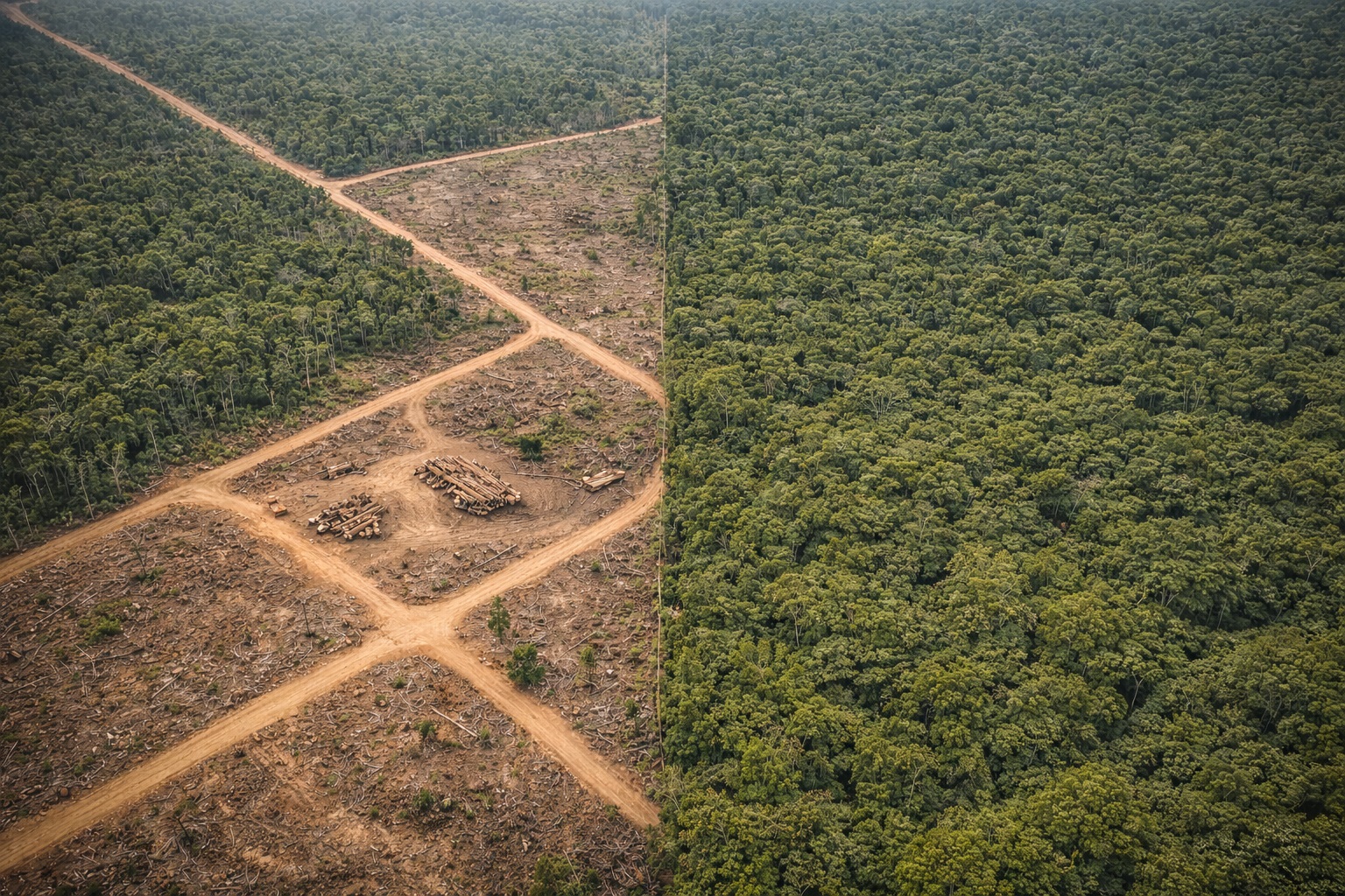
Timber & Concession Company
"How do we demonstrate FSC compliance across our entire concession?"
ForestWatch continuously monitors canopy integrity within and around the concession boundary. Monthly compliance reports document that extraction has remained within licensed zones — providing the satellite evidence layer required by FSC and EUDR (EU Deforestation Regulation) auditors.
Value: EUDR compliance documentation automated